Wetland habitat restoration at a landscape scale
Great North Fen – Restoring the Durham Carrs
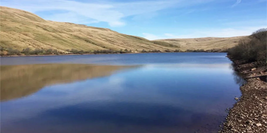
Historic fenland habitats have become a rare natural asset following centuries of drainage and agriculture. As our climate becomes wetter, these landscapes are becoming more difficult to farm. Durham Wildlife Trust (DWT) has an ambitious plan for a Great North Fen, showcasing 800 hectares of cost-effective landscape restoration of priority wetland habitats, helping landowners adapt to a changing climate and delivering benefits for biodiversity, flood risk and carbon capture.
We supported DWT to deliver the first two of potentially many wetland habitat restoration schemes – from concept phase through to detailed design. Construction work was completed in 2024.
We brought together a lean and integrated team of civil engineering, environmental, hydrological, landscape architecture, town planning, and water engineering services to design an exemplar wetland creation scheme.
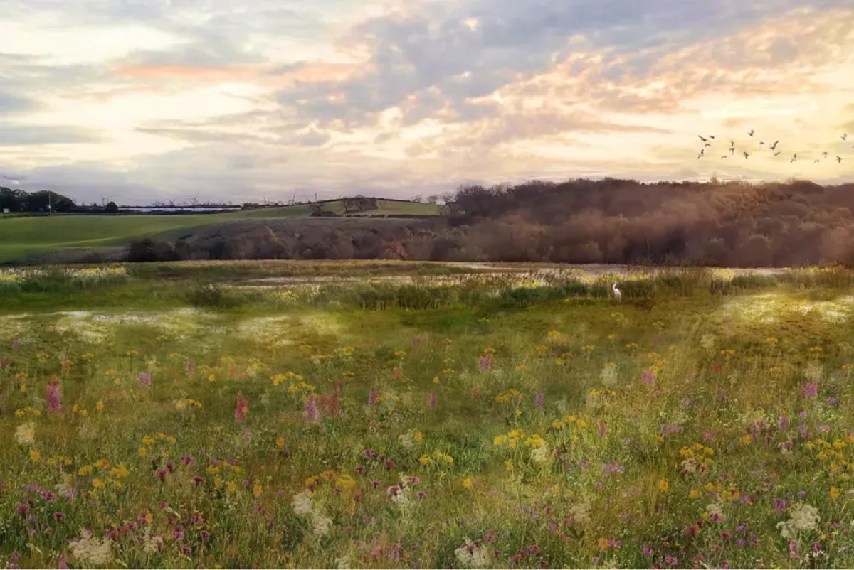
Our team worked closely with DWT to ensure the scheme’s deliverability. We realised time and cost savings by using 3D modelling to develop an efficient and adaptable design and applying lessons learned between phases. Photorealistic digital visualisation supported public engagement, helping to secure additional funding.
Durham Carrs is a cost-effective scheme that restores historic habits while minimising flood risks. It serves as an exemplar site to demonstrate to farmers and landowners the potential of their land for use in green finance markets for biodiversity net gain and housing nutrient neutrality schemes.
We completed comprehensive research to understand the existing conditions and influences on the site. This meant that we could design a scheme that was sustainable and would support itself through natural processes without the need for extensive ongoing interventions.
Using a pragmatic approach, this project demonstrates that focusing inputs on a river floodplain rather than the river itself can deliver substantial habitat restoration benefits, which are achievable and repeatable at scale.

We brought together a lean and integrated team of civil engineering, environmental, hydrological, landscape architecture, town planning and water engineering services. Visualisations were used to communicate the project to local groups. This is the before of Eldon Moor.
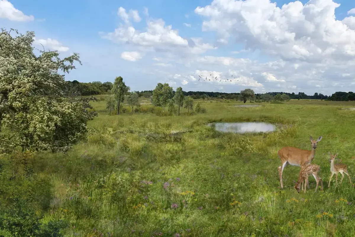
Visualisation: Eldon Moor after.
River restoration
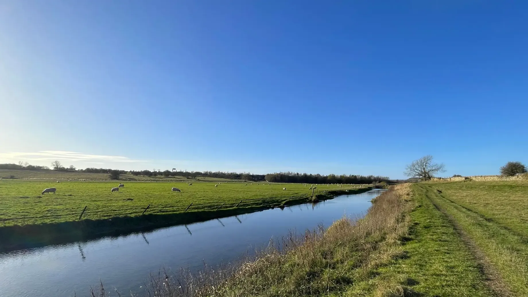
In lowland environments such as the Durham Carrs, catchment hydrology is very finely balanced and flood risk easily increases if the wrong rewetting interventions are introduced. During our work on Bishop’s Fen, DWT initially wanted to realign the river, which had been straightened along the side of farm fields. We thoroughly explored all options but determined that it would not be possible to do this without causing water to back up for kilometres upstream. The land upstream is privately held outside of the scheme so we needed to ensure neither DWT, nor the scheme, would be exposed to liabilities associated with increased upstream or downstream flood risk.
We were able to work with DWT to develop an intervention that wetted portions of the landscape without realigning the river. This solution achieved reasonable restoration of the site for a lower cost without increasing flood risk. The proposed intervention was consented through the planning process and we were able to apply the lessons learned to the second site at Ricknall Carrs.
At Ricknall Carrs we took an equally pragmatic approach. We identified the river’s possible original path and designed and scraped a similar channel through the floodplain that mimics a sinuous river bend. The current scheme has opted not to touch the main river – mitigating cost and offsite impact challenges for DWT and enabling the scheme to progress and be consented within a feasible timeframe.

We were able to work with Durham Wildlife Trust to develop an intervention that wetted portions of the landscape without realigning the river. This is the before of Mordon North.
Visualisation: Mordon North after.
Hydrology and groundwater
As so much of the delivery cost for these schemes would be in the earthworks, it was crucial that we presented DWT with as complete and accurate a picture as possible of the volume of earthworks required. Key earthworks included digging holes, scrapes, and channels into the flood plain, and redistributing the earth elsewhere.
We initially completed 2D drawings to calculate the volume of earthworks required, before using Civil 3D to generate models of the site and proposed interventions. By completing volume calculations within the software, we could model the different surfaces to ensure our designs had the correct storage capacity. We could then extract these surface volume calculations into the hydraulic model, as well as using them for technical drawings and proposed seeding plans.
Using Civil 3D meant we were able to quickly and easily tweak alignments, leading to more efficient designs that could capture and hold more water on the fields to help restore them to wetland habitats.
Through the modelling and design phase, we worked closely with DWT to determine its likely upper budget for the construction works. We could then rapidly generate a calculation of the optimum amount of earthworks for its budget, and scale interventions proportionately. Working in this way meant we were able to save a lot of time on modelling and optioneering, as well as helping DWT to manage its budget constraints.

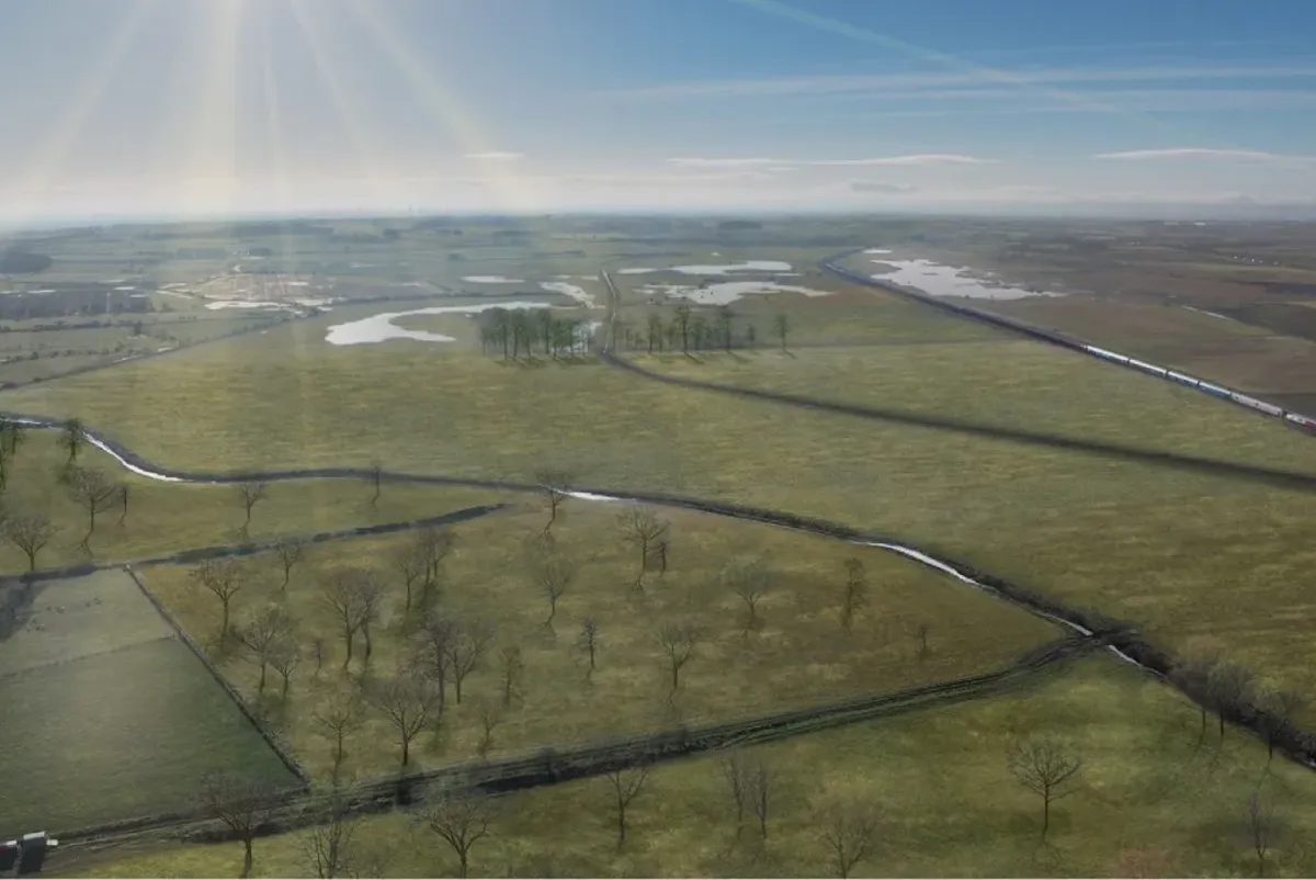
Using Civil 3D meant we were able to quickly and easily tweak alignments, leading to more efficient designs that could capture and hold more water on the fields to help restore them to wetland habitats. This is the before of Horse Close.
Visualisation: Horse Close after.
Projects
Explore more water resource projects
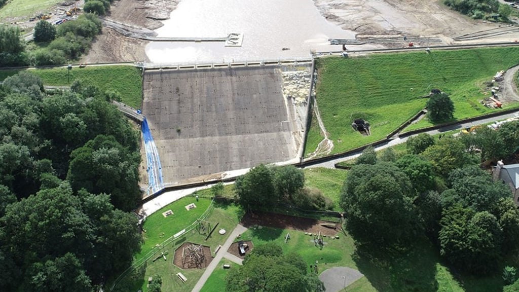
Safeguarding the future of Toddbrook Reservoir
Toddbrook Reservoir, United Kingdom

Delivering an integral link into Adelaide's existing water supply network
Adelaide Desalination Plant Transfer Pipeline System, Australia

A decade of sustainable water supply for Melbourne Cricket Ground and wider Yarra Park
Yarra Park Water Recycling Facility, Australia
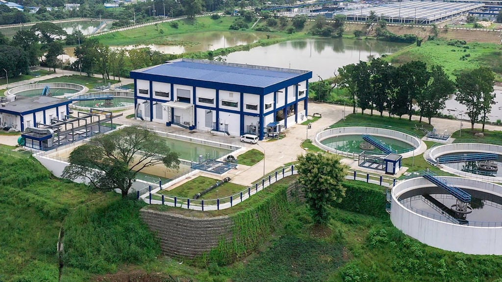
Upgrading the Philippines’ largest water treatment plant
La Mesa Water Treatment Plant 1, Philippines
Get in touch with us
If you'd like to speak to one of our water experts about any of the issues raised on this page or a potential collaboration then please get in touch by completing the form.